 |
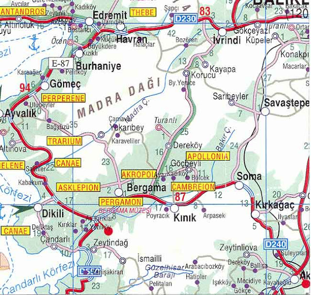
| Bergama maps |
Before the Persian invasion of 546 BC, the region of Pergamon was under Lydian domination. After the death of Alexander the Great (323 BC), one of his generals, Lysimachos, chose Pergamon, a stronghold where he built a citadel, to deposit his vast fortune (9,000 talents of gold) amassed during the wars. Upon his death, one of his lieutenants, Philetairos (282-263 BC), used this fortune and strategic place to found the independent dynasty of the Attalid kings. Rapidly, Pergamon became the capital of a flourishing Hellenistic kingdom. Attalos I (241-197 BC) and Eumenes II (197-159 BC) extended the kingdom to the rich provinces of Mysia, Lydia, Pamphilya, Phrygia. Its numerous architectural splendors and high cultural level made the city prominent. As regards trade, Pergamon was the rival of Ephesus. On the artistic and intellectual plane, it was the rival of Alexandria (they both had the most important libraries in the ancient world, that of Ephesus coming 3rd) and Antioch (Antakya). When the Ptolemies prohibited the export of papyrus to Pergamon, the use of sheep or goat skin, already long established in the city, was improved and a new writing material, the “Pergamene” (later evolved into the word parchment) was born. The finest parchment, made of calf, was known as vellum. More flexible than papyrus and more easily folded, allowed scribes to transition from writing on scrolls to writing in books.
Source: www.guide-martine.com