Friday, January 11, 2013

Ağrı Maps

Ağrı Maps
Ağrı Maps
In the Ottoman Empire era the area was called Şorbulak, and the settlement was called Karakilise (Black Church). At that time, the district's administrative centre was located at Alashkert, once an important town. In 1895, Lynch wrote that Karakilise had between 1500-2000 inhabitants, was nearly two-thirds Armenian, and that a barracks for the Hamidiyeh regiment was located in the town. The Armenian population of the town and surrounding valley was massacred during the Armenian Genocide: a New York Times report from March 1915 talks of the Alashkert valley being covered with the bodies of men, women, and children.The "kara kilise" that gave the town its name was a medieval Armenian church. In the 1920s the town's name was mutated to Karaköse (the black man with no moustache) and the church was demolished. The name "Ağrı" might have been given by the Turkish government because of the Ağrı rebellion.

Source : wikipedia

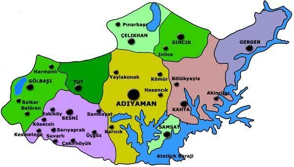
Adiyaman Maps

Adıyaman Maps
Adiyaman Maps
The city officially had the name Hısn-ı Mansur ("Castle of Mansur") until the year 1926, named after the fortified castle perched on a hill around which the city grew. As this name was difficult for the locals to pronounce, people were referring the city as adıyaman, which means "its name is tough" or "(the place) whose name is tough" in Turkish. In 1926, this term was adopted as the official name of the city. In present-day Turkish, the word yaman can also have a strong positive connotation, just like the English word 'terrific'.

Source : Wikipedia

Thursday, January 10, 2013

Adana Maps

Adana Maps
Adana Maps
Adana  is a city in southern Turkey and a major agricultural and commercial center. The city is situated on the Seyhan River, 30 km inland from the Mediterranean Sea, in south-central Anatolia. It is the administrative seat of the Adana Province and has a population of 1.6 million, making it the most populated city of the region. Adana-Mersin metropolitan area, with a population of 4.5 million, stretches over 100 km from east to west and 25 km from north to south; encompassing the cities of Mersin, Tarsus, Adana, and Ceyhan.
Adana lies in the heart of Çukurova, a geographical, economical and cultural region that covers the provinces of Mersin, Adana, Osmaniye, and Hatay. Home to approximately six million people, the region is mostly a large stretch of flat, fertile land regarded as one of the most agriculturally productive areas of the world.

Source: wikipedia

Antalya maps

Antalya maps
Antalya maps
Antalya was formerly called Attalaia, a name derived from Attalus II, king of Pergamum, who founded the city in the 2C BC. The port city became the capital of Pamphylia and was protected by walls in 130 AD. These walls were reinforced in the 10C. During the Crusades, the place became the port of embarkation to Palestine. Taken by the Seljuk Turks in 1207, it was incorporated to the Ottoman Empire at the end of the 14th century.

Monday, January 7, 2013

cappadocia maps

cappadocia maps
cappadocia maps

Cappadocia (Kapadokya) is a region of exceptional interest, because of the fantastic and almost unreal character of its landscapes, because of its history and because of the way of life of its populations. Cappadocia covers a triangle area between Kayseri, Nigde and Nevsehir where two volcanoes, the Erciyes Dag (Mount Argaeus) and the Hasan Dag reach 3916m /12,850 ft and 3268m / 10,720 ft at their highest point. 

Cappadocia is a vast tuff plateau which relief has been ragged by thousand million years of erosion: wind, rain water and snow have sculpted this unique scenery with canyons and fairy chimneys (Peribacalari) which are soft conical formations with hard basalt caps that defy the laws of balance... Troglodytism which has been a way of living for centuries, can be seen everywhere: cave-dwellings, caves, pigeon houses, churches, monasteries. 

Source : guide-martine

Side Maps

Side Maps
Side Maps


Side is located on a small peninsula, 80 kilometers/ 50 miles to the east of Antalya. It was one of the most important cities in the vast coastal plain known in Antiquity as Pamphylia. 
Side is an ancient harbour that was founded in the 7th century BC by Aeolian colonists who had come from the north of Smyrna. The name Side, which means "pomegranate", is thought to have been the symbol of the city because it was represented on the local coins. Before and after the Hellenistic period, taking advantage of the natural location of their city built on a long peninsula, the inhabitants of Side were indulged in the practices of piracy which were more remunerative than shipbuilding activities. The place was also long reputed as a slave market. In the 3rd century BC, Side came under the domination of the Ptolemy of Egypt and Seleucids of Syria. From the 2nd and 1st century BC, due to its good relations with Rome, Side, now devoted to trade, enjoyed a first period of prosperity. After the establishment of the "Pax Romana" (Roman Peace), between the 2nd-3rd century AD, Side reached its peak as can be seen through the numerous monuments built at that period. In the 4th century, the city declined altogether with the Empire. 

Source: guide-martine

Tuesday, January 1, 2013

Sirince Maps


Set in the hills 8 kms/ 5 miles above Selçuk, this picturesque charming village was once named Kirkince by its Greek inhabitants who settled here by the end of the 18th century. After the great exchange of population following the establishment of the Turkish Republic, the village was repopulated by Turkish people who called it Çirkince, a distortion of Kirkince (which in fact was how the Greeks pronounced the Turkish name Kirkinca!). As the word Çirkince means “ugly” in the Turkish language, the name was finally transformed in Sirince which means “pretty” and which really suits the village.

Source www.guide-martine.com

Marmaris Maps

Marmaris Maps
Marmaris Maps


Marmaris is a major and attractive holiday resort located in a very beautiful scenery bay surrounded by mountains which dip into the blue waters and are covered with pine-tree forests. Local pine scented honey, called “Çambali”, is delicious and renown.
The ancient city of Physcus was an important stage on the Anatolian-Rhodes-Egypt trade route. Modern Marmaris developed around the Ottoman fortress built by Süleyman the Magnificent most probably after the Rhodian campain he led in 1522. At the entrance of the narrow street with steps leading up to the fortress, there is a caravanserai from the same period bearing an inscription dated 1545. The fortress was partially destroyed by cannon balls launched from a French warship in 1914 during the First World War. The fortress was restored between the years 1980-1990 and opened to the public as the Museum of Marmaris. The museum has an archaeological section displaying objects unearthed during the excavations at Hisarönü, Cnidos and Burgas near Datça, an ethnographical section and an art gallery. The old houses within the fortress have also all been restored. 

Source www.guide-martine.com

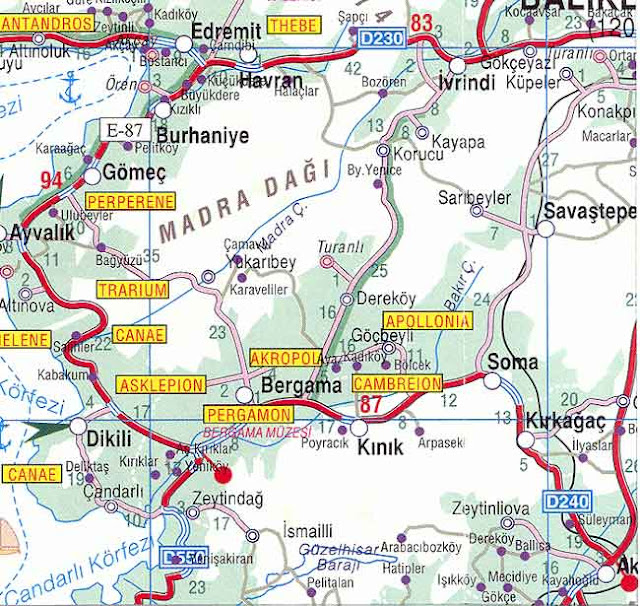
Bergama maps


Bergama maps
Bergama maps
The city of Bergama and the archaeological site of Pergamon (or Pergamum) are located in the Bakırçay (Kaikos) river basin, a fertile area of ancient Mysia, approximately 100 kilometers/ 62 miles north of Izmir. 
Before the Persian invasion of 546 BC, the region of Pergamon was under Lydian domination. After the death of Alexander the Great (323 BC), one of his generals, Lysimachos, chose Pergamon, a stronghold where he built a citadel, to deposit his vast fortune (9,000 talents of gold) amassed during the wars. Upon his death, one of his lieutenants, Philetairos (282-263 BC), used this fortune and strategic place to found the independent dynasty of the Attalid kings. Rapidly, Pergamon became the capital of a flourishing Hellenistic kingdom. Attalos I (241-197 BC) and Eumenes II (197-159 BC) extended the kingdom to the rich provinces of Mysia, Lydia, Pamphilya, Phrygia. Its numerous architectural splendors and high cultural level made the city prominent. As regards trade, Pergamon was the rival of Ephesus. On the artistic and intellectual plane, it was the rival of Alexandria (they both had the most important libraries in the ancient world, that of Ephesus coming 3rd) and Antioch (Antakya). When the Ptolemies prohibited the export of papyrus to Pergamon, the use of sheep or goat skin, already long established in the city, was improved and a new writing material, the “Pergamene” (later evolved into the word parchment) was born. The finest parchment, made of calf, was known as vellum. More flexible than papyrus and more easily folded, allowed scribes to transition from writing on scrolls to writing in books. 

Source: www.guide-martine.com

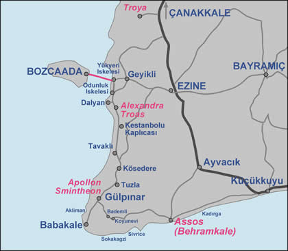
Assos Maps

Assos Maps
Assos Maps


Located about 90 km south of Çanakkale, Assos is a lovely tiny fishing harbour and holiday resort very popular among Turkish people because of its preserved natural appearance and rustic charm. 
The ruins of ancient Assos lie within the village of Behramkale on a hill offering scenic views of the Biga Peninsula, Edremit Gulf and the nearby Greek island of Lesbos (in Turkish Midilli Adasi) and also unforgettable sunsets.


Source www.guide-martine.com

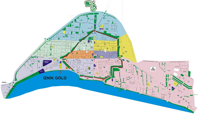
Iznik maps

Iznik
Iznik

Iznik, the ancient Nicaea, is located in the north-east of Bursa on the side of the Iznik Lake. İznik was founded in 316 BC under the name of Antigoneia by Antigonus and was later expanded by Lysimachus who named the city after his wife Nicea. Later the city was taken and ruled by the Bithynians, the Romans, the Goths and once again by the Romans. Under Constantine I when Christianity became state religion, Nicea then became an important religious center where, in 325 and 787, two ecumenical councils were held. The first one, under Constantine I, formulated the dogmatic statements of Christian orthodoxy (the Nicene Creed) and defined the role of the emperor both as head of the Church and head of the State. The second one was convoked by Irene and his son Emperor Constantin VI to rule on the use of saints images and icons, after the period of a strong movement called Iconoclasm .